Know Your Natural Areas
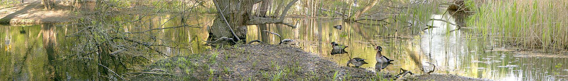
Our city contains extensive natural areas that support remarkable biodiversity, contribute to flood control and clean air, increase resiliency in the face of climate change, enrich our lifestyles and property values, and add to global sustainability.
To find the natural areas in your ward:
- Select the ward number on the map or
- Pick from the list below the map
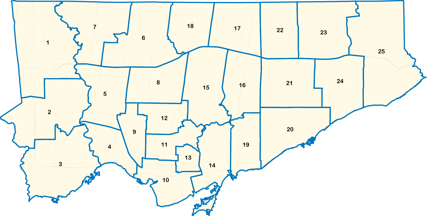
Ward 1 – Etobicoke North
Ward 2 – Etobicoke Centre
Ward 3 – Etobicoke-Lakeshore
Ward 4 – Parkdale-High Park
Ward 5 – York-South Weston
Ward 6 – York Centre
Ward 7 – Humber River-Black Creek
Ward 8 – Eglinton-Lawrence
Ward 9 – Davenport
Ward 10 – Spadina-Fort York
Ward 11 – University-Rosedale
Ward 12 – Toronto-St. Paul’s
Ward 13 – Toronto Centre
Ward 14 – Toronto-Danforth
Ward 15 – Don Valley West
Ward 16 – Don Valley East
Ward 17 – Don Valley North
Ward 18 – Willowdale
Ward 19 – Beaches-East York
Ward 20 – Scarborough Southwest
Ward 21 – Scarborough Centre
Ward 22 – Scarborough-Agincourt
Ward 23 – Scarborough North
Ward 24 – Scarborough-Guildwood
Ward 25 – Scarborough-Rouge Park
Image source: © City of Toronto
Other Maps & Lists
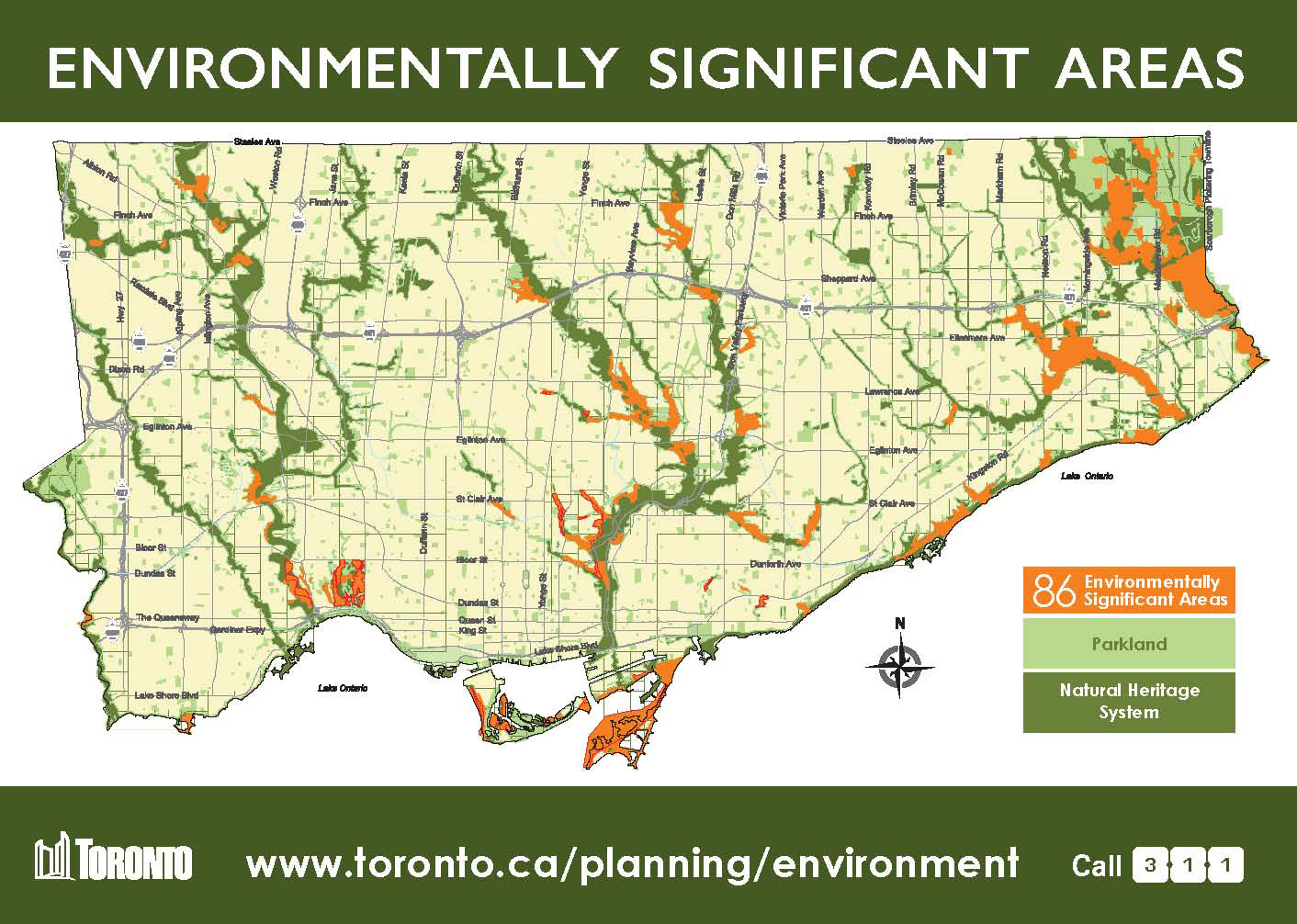
Overview: Toronto’s Environmentally Significant Areas Map
For more details: City Interactive Map (Help Instructions are available at the top of the map)
Toronto’s Ravines and Natural Parklands including Trails, ESAs, Biodiversity booklets, Cycling and Ravine Management